Develop land use and transportation planning scenarios that explore how transportation and development patterns affect each other. Explore how these address transportation needs and their overall impacts on the quality of life. Gather input and ideas on these scenarios from local stakeholders and the public to develop a preferred scenario.
Based on current population growth, it is expected that well over one million people will be added to our region by 2040. A lot of work is needed to prepare for this growth.
Because it’s impossible to know how this growth will unfold, exploring a variety of plausible future outcomes helps us plan for an uncertain future. Scenarios are a way to help explore how potential transportation decisions affect, are affected by, and ultimately fit with development patterns. When a road or transit line is built, it influences where people want to live and work, and ultimately the location of new development. This also shapes how and where people travel and what transportation solutions make sense to build.
As part of the 2015-2040 Regional Transportation Plan (RTP), the Wasatch Front Regional Council (WFRC) created four planning scenarios to review with partners, stakeholders, and the public. Based on the feedback, one preferred scenario was created.
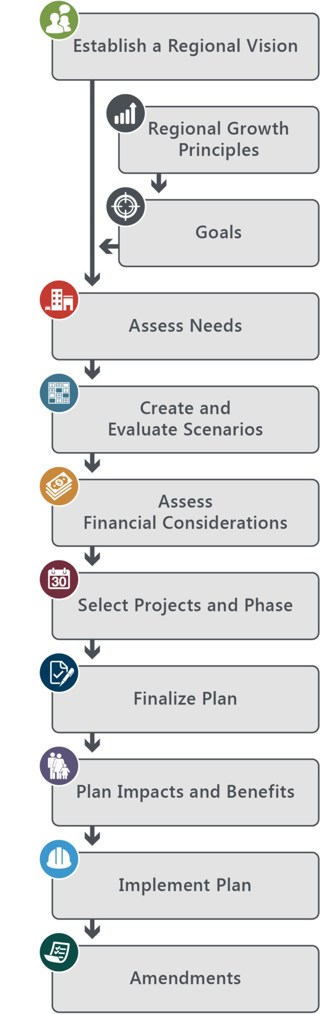
The following diagram provides a better understanding of how scenarios fit into the 2015-2040 RTP development process.


For additional information regarding the RTP, please contact Jory Johner.