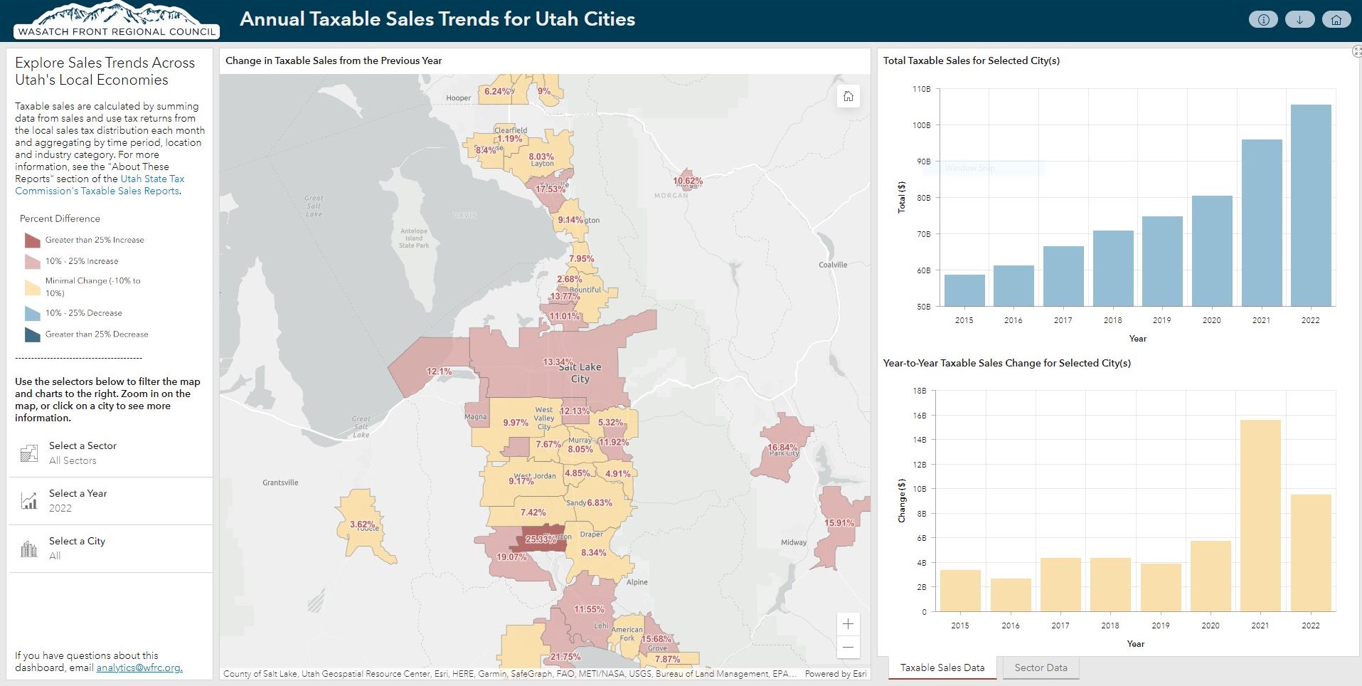
Compare year-to-year taxable sales between 2015 and 2022, using data from the Utah State Tax Commission (USTC), for mid and large-sized cities. This new dashboard is an upgrade to our previous COVID-era taxable sales map, so you can view these trends in a more interactive fashion.
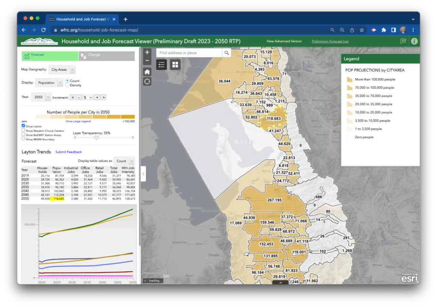
Map of the Month: Household and Jobs Forecast Web Map
What will the Wasatch Front look like in ten years? How about in 2050?
In support of WFRC’s long-range planning work, our Analytics Group is responsible for projecting where people will live and work in our region in the future. Our forecasting is done for traffic analysis zones (TAZs), which average about one square mile in size, and relies on real estate development modeling software, a diverse collection of input datasets, and input/feedback from local government and other stakeholders.
Important inputs to the forecasting process include parcel-level data from county assessors, current job counts and locations, local government general plans, the Wasatch Choice Vision for transportation and land use, and county-level projections compiled by the Gardner Policy Institute.
WFRC’s current household and jobs forecast update is expected to be finalized in May of 2023 and will be used in conjunction with transportation investment decisions and other local and regional planning work. But you don’t have to wait until then to start exploring this current update at the TAZ and ‘city area’ levels in our Household and Jobs Forecast web map.
The web map lets you view projections for specific years, display and graph changes, intensities, and select from several geographic summary levels. Have fun touring our future projections, but don’t forget to come back to the present and do your part to keep us on the best path forward.
Related Posts