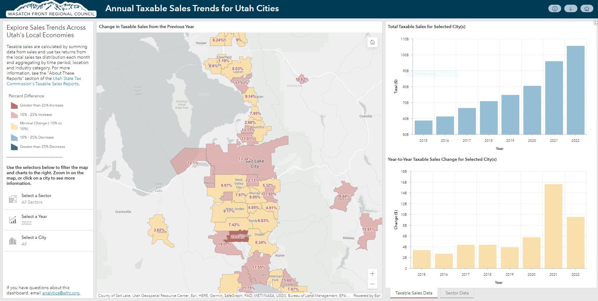
Compare year-to-year taxable sales between 2015 and 2022, using data from the Utah State Tax Commission (USTC), for mid and large-sized cities. This new dashboard is an upgrade to our previous COVID-era taxable sales map, so you can view these trends in a more interactive fashion.
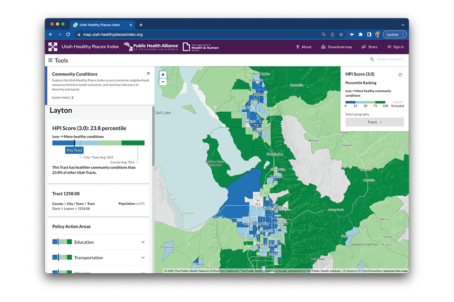
Map of the Month: Utah Healthy Places Index
On October 20th, Utah Department of Health and Human Services released its new and innovative mapping tool, the Utah Healthy Places Index (HPI).
The Utah HPI provides community leaders, policymakers, planners, transportation agencies, and other stakeholders sound and validated, neighborhood-level data on community conditions known to impact health, such as job opportunities, education, and transportation.
State and local stakeholders can use the Utah HPI alongside input from community residents to prioritize investments, resources, and programming in neighborhoods where health needs are greatest, ensuring that all residents have what they need to be healthy.
Planners and transportation agencies can use the tool to analyze data and prioritize resources as they update their regional or local area plans, including future investments in health-promoting infrastructure such as transit service, parks, multi-use pathways, and bike lanes.
Regional organizations that span multiple communities or regions of Utah can use the tool to study the different areas they serve and advocate for increased resources and greater investments in these locations.
The Utah HPI allows users to:
- Compare data across geographies,
- Filter geographies by race, ethnicity, and country of origin,
- Access hundreds of decision-support indicators, including walkability, transit access, affordable housing and transportation costs, and others,
- Views data by census tract, zip code, cities, counties, legislative districts, and other useful geographies,
- View side-by-side map comparisons, and
- Explore detailed evidence-based policy guides tailored to the needs of communities.
This map was created with input from a number of stakeholders including WFRC, UDOT, and UTA.
Related Posts