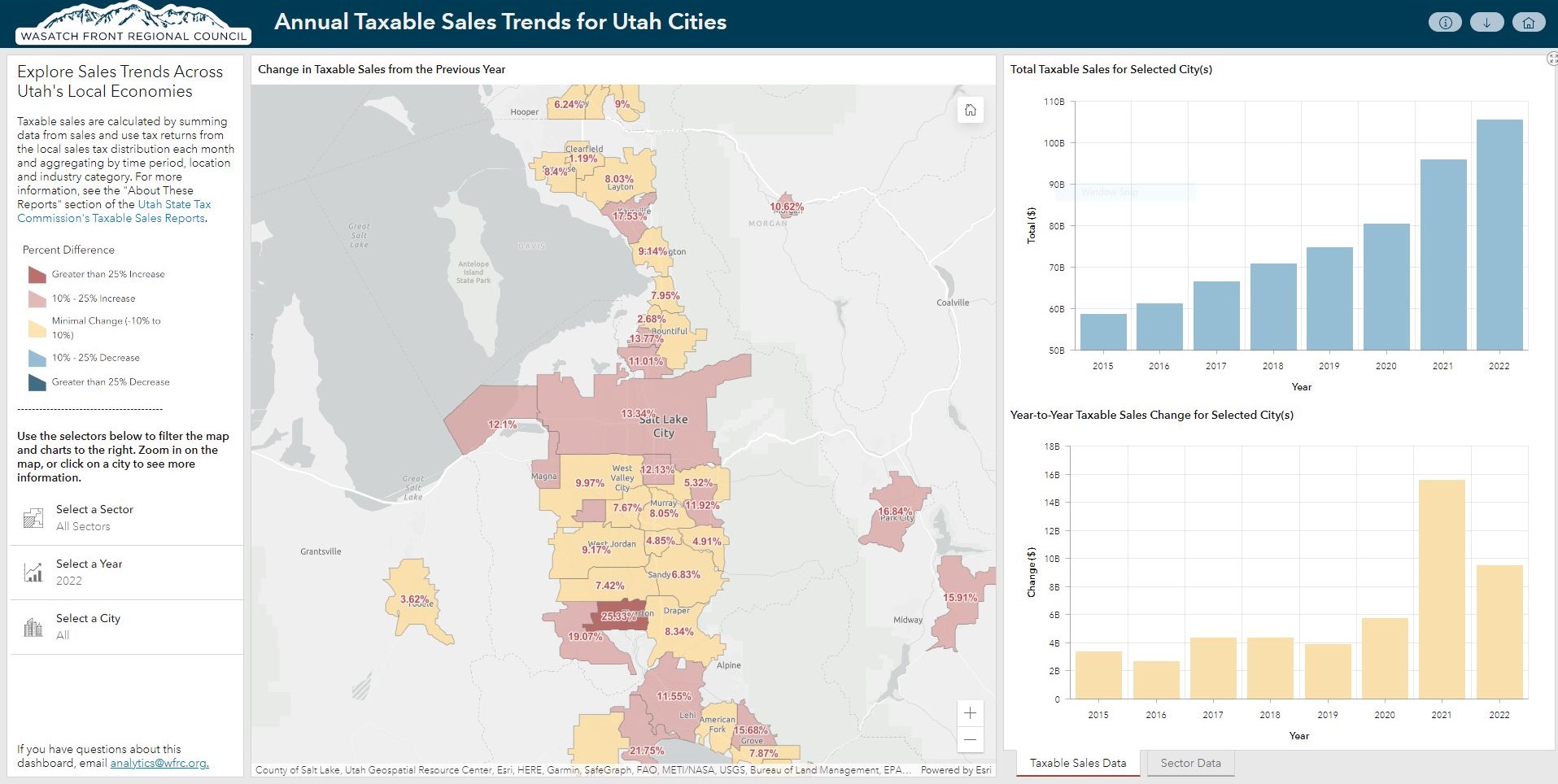
Compare year-to-year taxable sales between 2015 and 2022, using data from the Utah State Tax Commission (USTC), for mid and large-sized cities. This new dashboard is an upgrade to our previous COVID-era taxable sales map, so you can view these trends in a more interactive fashion.
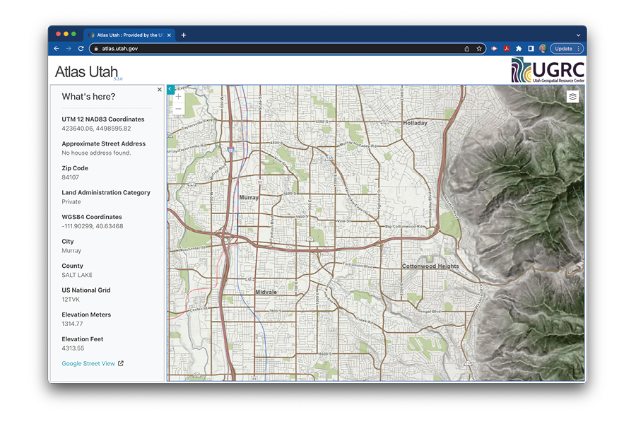
Map of the Month: atlas.utah.gov
Whether you want to explore your neighborhood or a spot for your next Utah outdoor adventure, our September map of the month, atlas.utah.gov, is a great general purpose map viewer. What’s cool about this map and placefinder is that it is built entirely from Utah’s own, vast set of GIS data resources that are compiled and distributed by the Utah Geospatial Resource Center (UGRC).
Success with digital mapping is completely dependent on the availability of quality, up-to-date map data. It would be nearly impossible to work alone in this space. Luckily, Utah’s cities, counties, and state agencies are recognized for their leadership, skill, and collaboration to bring map data together for many important uses including emergency response, stewardship of our natural areas, and infrastructure planning and management.
A sampling of the many map layers depicted in the atlas site include: roads, address points, city boundaries, elevation/topos, transit and cargo rail, public lands, and Fall 2021 high resolution aerial photography.
But, this is just scratching the surface of the mapping data that can be found and downloaded from Utah’s State Geographic Information Database – one of the most visited utah.gov websites.
Count WFRC as a benefactor, contributor, and strong supporter of everyone’s work to keep Utah among the best-mapped states in our nation.
Related Posts