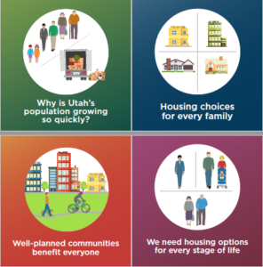
Utah has been the fastest growing state in the nation for the past ten years, and that growth is continuing; we’re on pace to nearly double in population in the next 30 years. That means the pressures that come with growth — and the sometimes difficult community conversations that accompany them — will be with us for some time. Add in the recent challenges brought on by COVID-19 and the impacts associated with the health, economic and other concerns we are facing from the pandemic, the twin challenges of rapid growth and COVID-19 both require our attention. Addressing these challenges will require input from and collaboration with the residents across our communities.
As communities update their plans, they can explore implementation of the Vision, which focuses on coordinating the planning and location of land use, housing, transportation, economic development, and open space to achieve the best outcomes. The vision also relates to Senate Bill 34 from 2019, which changed general plan requirements. That bill seeks to address housing affordability and also requires communities to dovetail their land use with local and regional transportation planning.
The Partners of the Wasatch Choice Vision met regularly during the pandemic and created several assets to help those interactions happen more effectively. As communities move forward, the following resources can help:
Developed as a resource to help leaders and staff develop and implement plans and policies that benefit from broad stakeholder ownership.
The guide contains resources organized around three main topics:
- Public Engagement: Process and tips for planning and executing effective dialogue and engagement with public groups.
- One-on-One Engagement: Tips and data to aid in having more effective conversations with individual members of the public on difficult topics.
- Messaging: Ready messaging for use in describing our challenges, and, when applicable, the role of the shared Wasatch Choice Vision in meeting them.
Access to Opportunities: how many valued destinations can you get to from each spot in your community. Or how many patrons or potential employees can reach each site in your community. This helps inform economic development site selection and locations for moderately priced housing.
General Future Land Use: summarizes the designated land uses in the general plans within the WFRC MPO planning boundary. While this map layer is not a substitute for the detailed local plans available directly from cities, it presents consistent land use types, ex. single-family residential, mixed use, and parks/sensitive lands, etc.
Open space: Wasatch Front Parks and Trails Map spotlights park space, family-friendly pathways, and the accessibility of these critical assets within a 10 minute walk. This can help us understand our current strengths and where additional amenities may be needed as we grow.
Growth Projections: neighborhood level demographic and employment projections are prepared by Utah’s four MPOs, together with UDOT for the state’s non-urbanized areas to support the transportation planning process. They also support local planning to address anticipated growth. For the Wasatch Front, a new 2050 projections viewer tab was added to the Wasatch Choice map.
Statewide Traffic Volume Map (Historic and Forecasted): The WFRC-hosted Traffic Volume Webmap allows anyone to access forecasted and observed data for all major roads in Utah.
Active Transportation GIS Data Resources: bike use has increased by nearly 100% during the pandemic, and our region is likely to see lasting gains in biking for commuting and for recreation. This data helps ongoing planning by offering:
-
-
- Existing pathways and on-street bike infrastructure
- Plans for new regional and local AT facilities
- A future “build-out” view of the bicycle network
- Bike and pedestrian demand indicators
- Level of traffic stress and other Network Quality measures
-
The Wasatch Choice partners have developed the Wasatch Choice Toolbox to help communities explore the Wasatch Choice Vision with residents and enact locally-driven plans according to the community’s goals. A number of planning tools have been developed to help in this effort.
- SB34 encourages local communities to plan for housing for residents of all income levels, and coordinate that housing with transportation. Communities are required to develop a moderate-income housing (MIH) plan as part of their general plan. Communities that are required to annually report on their MIH plan implementation must satisfy these requirements to remain eligible for state transportation investments.
- Active Transportation Plan Standards is a set of compiled standards that help to create a more comprehensive network of active transportation facilities in Utah.
- Statewide Resource Summary is a one-stop list of resources available to help assist local governments in planning. A key challenge is knowing what is available and whom to contact.
- Complete Streets is a web-based platform designed to foster informed dialogue between the public and community leaders.
- Envisioning Centers is a planning and guided implementation process for smaller areas that enables a community to explore a range of scenario options and weigh the associated benefits and challenges.
- Envision Tomorrow Plus is a comprehensive scenario planning tool, which allows the user to see and compare the outcomes and impacts of potential policy and development decisions in terms of multiple economic, demographic, and environmental indicators.
- Form-Based Code is a tool to help facilitate the establishment of a form-based code ordinance, which emphasizes physical form to regulate and guide development, as well as implement the vision for a place.
- Housing and Opportunity Assessment is an in-depth report that provides current data, maps, and information regarding demographics, socio-economics, and housing in communities along the Wasatch Front.
- Implementing Centers is a mechanism for communities to assess barriers to development of higher density and mixed-use centers, as well as develop strategies to overcome these barriers.
- Utah Street Connectivity Guide is a comprehensive resource for improving street connectivity in communities throughout Utah.
For additional information regarding the Wasatch Choice Toolbox, please contact Ted Knowlton.
Schedule Coming Soon

