Biking and walking typically fall under the term active transportation, but any form of travel powered by the human body such as using a wheelchair, skateboarding, scootering, or roller-blading is active transportation as well.
There are many community and individual benefits to active transportation, including increased wellness and social connectedness, travel cost savings, mobility independence, reduced environmental impact and improved air quality. Additionally, every time you opt to walk or bike rather than travel in your car, there is one less car on the road – making it easier for those who have to drive to get around.
Supporting active transportation is consistent with all of the Wasatch Front Regional Council’s Wasatch Choice Vision goals. WFRC participates in many active transportation planning efforts, understanding that travel choices are critical to maintaining and building an efficient and integrated transportation system for the region. The Transportation and Land Use Connection program provides funding to local governments to develop active transportation plans and the Active Transportation Committee involves regional stakeholders to provide guidance on bicycle and pedestrian planning issues. All active transportation planning efforts undertaken involve partners such as the Utah Department of Transportation; Utah Transit Authority; WFRC member counties and cities; state and local health departments; and state and local advocacy groups.
The 2019-2050 Regional Transportation Plan (RTP) focuses on planning a bicycle network that is both safe and convenient for users. Where possible, family-friendly facilities that separate bicycles from vehicle traffic are planned. Additionally, the RTP focuses on regional connections to ensure that origins and destinations are conveniently linked along with improved connections to transportation services, such as bus and rail.
As the RTP is a long-range plan, planned active transportation projects identified in the RTP may evolve over time. During project development, context sensitive solutions will be considered to build out the preferred solution. Further jurisdiction coordination, deployment of interim designs, or phased implementation may be necessary until complete redesign or reconstruction of the roadway and active transportation facility occurs, and/or additional right-of-way can be acquired.
Overall, the 2019-2050 RTP places a growing emphasis on active transportation, considering access, convenience, and safety of bicycle users as well as integrating facilities within roadway and transit projects.
For additional information regarding active transportation, please contact Hugh Van Wagenen and visit the Active Transportation Committee for the most up-to-date information on bicycle and pedestrian planning issues.
Datsets:
- Active Transportation GIS Data Resources Interactive Map – This interactive map enables visualization of existing
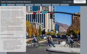 and planned on-street and off-street bicycle infrastructure, potential demand scores, and bike network quality / level of traffic stress. It also provides links to, and information about, the datasets.
 - Multimodal Network GIS Dataset – UDOT led a 2018-19 FHWA grant to create a GIS layer capable of supporting network analysis for bicycle, pedestrian, vehicle, and transit modes. As part of this project, Utah selected five metrics for implementation from the FHWA Guidebook for Measuring Multimodal Network Connectivity: Network Completeness, Network Density, Directness of Suitable Routes, Access to Destinations (travelsheds and inclusion of key amenities), and Network Quality (Level of Traffic Stress).
- Current On-street Bicycle Infrastructure – Improved bicycle GIS data, stored as attributes on Utah’s statewide road centerline GIS layer, is available from UGRC. The data schema (attribute names and coded values) is available from this google doc, see the purple Alternate Use section on the FC_RoadCenterlines tab for field properties and the CVDomain_OnStreetBike and the CVDomain_Ped Path tabs for allowable code values.
- Planned Bicycle Infrastructure – The road centerlines GIS layer described above also carries planned regional and local on/near bicycle infrastructure data — for the WFRC region — using the CVDomain_OnStreetBike coded values.
- Usage Count Datasets – WFRC has partnered with UDOT (and UTA & MAG) to obtain the Strava Metro licensed data product. A limited set of physical bike counters are in place in the WFRC region with additional fixed and mobile counters planned and funded in Salt Lake, Davis, and Weber Counties. For more information contact Hugh Van Wagenen at WFRC.
Tools:
- Micromobility Toolset (in progress) – WFRC led a joint project (with MAG, UDOT, and UTA) to develop requirements, create a implementation plan, and build an initial analysis toolset to better understand and project bicycle and other micromobility mode travel within our region. Information about this project can be found in the kickoff workshop summary, toolset needs assessment, and work plan for the second phase (build initial bicycle tools) of this project.
- Complete Streets Toolbox
- Active Transportation Plan Data Standardization – WFRC has created guidelines for standardization of Active Transportation Plan data. The guidelines document contains instructions for utilizing Utah’s statewide road centerline GIS layer in creating new AT Plan data, information about bicycle and pedestrian facility types, and FAQ.
